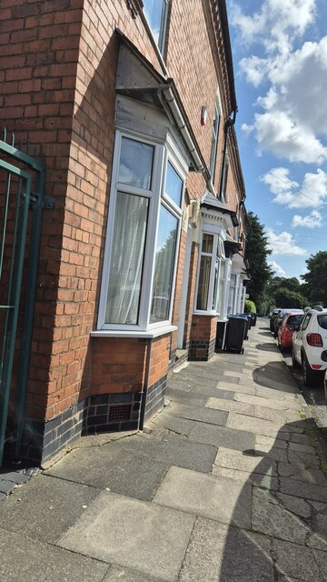
Terraced Houses with Benchmark, Hazelwell Road
Introduction
The photograph on this page of Terraced Houses with Benchmark, Hazelwell Road by Paul Collins as part of the Geograph project.
The Geograph project started in 2005 with the aim of publishing, organising and preserving representative images for every square kilometre of Great Britain, Ireland and the Isle of Man.
There are currently over 7.5m images from over 14,400 individuals and you can help contribute to the project by visiting https://www.geograph.org.uk

Image: © Paul Collins Taken: 26 Jul 2024
These houses were built around the end of the 19th century and front directly onto the pavement. No. 1 Hazelwell Road (the nearest house) boasts an Ordnance Survey cut benchmark, which is just visible. Hazelwell Road was, at least until the 1880s, an undeveloped lane branching off the Pershore Road (itself originally a Roman Road at this point) to serve as access to Hazelwell Mill. The mill, on the River Rea was, according to old maps, a 'gunbarrel factory' in 1882; and in 1903 and 1937 a 'rubber goods factory'. Its site is now occupied by a trading estate.

