Mountain Hall
Introduction
The photograph on this page of Mountain Hall by Marion Phillips as part of the Geograph project.
The Geograph project started in 2005 with the aim of publishing, organising and preserving representative images for every square kilometre of Great Britain, Ireland and the Isle of Man.

There are currently over 7.5m images from over 14,400 individuals and you can help contribute to the project by visiting https://www.geograph.org.uk
Mountain Hall
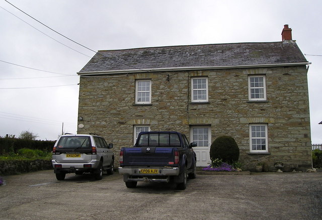
Image: © Marion Phillips Taken: 30 Apr 2008
It is unclear why this farm was called Mountain Hall as it on a flattish-topped ridge at no great height. I am told it dates back to about 1650 and was built by the Sheriff of Cardigan and was the main house in a large estate. It used to be limewashed but removal of the many layers of lime revealed some very nice stonework.
Images are licensed for reuse under creativecommons.org/licenses/by-sa/2.0
Image Location
Latitude
52.004819
Longitude
-4.354248