Old Boundary Marker beside the B3280 in Praze-an-Beeble
Introduction
The photograph on this page of Old Boundary Marker beside the B3280 in Praze-an-Beeble by P Barnett as part of the Geograph project.
The Geograph project started in 2005 with the aim of publishing, organising and preserving representative images for every square kilometre of Great Britain, Ireland and the Isle of Man.

There are currently over 7.5m images from over 14,400 individuals and you can help contribute to the project by visiting https://www.geograph.org.uk
Old Boundary Marker beside the B3280 in Praze-an-Beeble
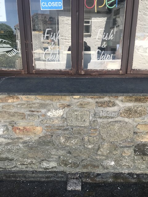
Image: © P Barnett Taken: 25 Jun 2024
Boundary Marker on the north side of the B3280 in Praze-an-Beeble, set in the wall of the fish and chip shop, no.2 The Square, at ground floor level under the shop window. Crowan parish. Inscribed H E, its function is unknown. Milestone Society National ID: CW_CROW08bm
Images are licensed for reuse under creativecommons.org/licenses/by-sa/2.0
Image Location
Latitude
50.173768
Longitude
-5.311567