Benchmark in Station Road, Ruthin
Introduction
The photograph on this page of Benchmark in Station Road, Ruthin by John S Turner as part of the Geograph project.
The Geograph project started in 2005 with the aim of publishing, organising and preserving representative images for every square kilometre of Great Britain, Ireland and the Isle of Man.

There are currently over 7.5m images from over 14,400 individuals and you can help contribute to the project by visiting https://www.geograph.org.uk
Benchmark in Station Road, Ruthin
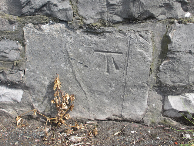
Image: © John S Turner Taken: 4 Aug 2012
Ordnance Survey benchmark on the stone wall alongside Station Road, Ruthin. The mark is almost opposite the exit lane for the CO-OP supermarket. The mark was levelled at 60.82m above Newlyn Datum. For a wider view see: Image Benchmark Database: https://www.bench-marks.org.uk/bm224376
Images are licensed for reuse under creativecommons.org/licenses/by-sa/2.0
Image Location


Leaflet Map data © OpenStreetMap
Latitude
53.115089
Longitude
-3.306447