Fingerpost, Springrove Cross
Introduction
The photograph on this page of Fingerpost, Springrove Cross by Mr Red as part of the Geograph project.
The Geograph project started in 2005 with the aim of publishing, organising and preserving representative images for every square kilometre of Great Britain, Ireland and the Isle of Man.

There are currently over 7.5m images from over 14,400 individuals and you can help contribute to the project by visiting https://www.geograph.org.uk
Fingerpost, Springrove Cross
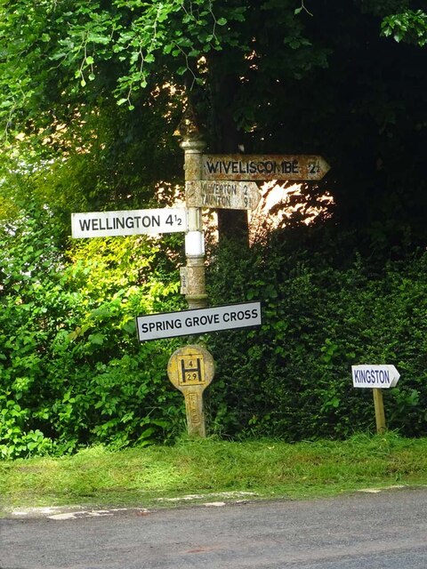
Image: © Mr Red Taken: 30 May 2024
On the NW corner of the crossroads. The principal road is u/c, Stone Hill Lane is on the left. The 4ᵗʰ finger was present in 2018 and the 5th in 2009. Four context views are included in Link Inscription: S / C C // Wiveliscombe 2¼ // Milverton 2 / Taunton 9¾ // Wellington 4½ // Langford Lakes 1 // [Bathealton] 1¾ // Spring Grove Cross Milestone Society National ID: SO_ST0924
Images are licensed for reuse under creativecommons.org/licenses/by-sa/2.0
Image Location
Latitude
51.016499
Longitude
-3.28847