Kingswood United Church
Introduction
The photograph on this page of Kingswood United Church by Neil Owen as part of the Geograph project.
The Geograph project started in 2005 with the aim of publishing, organising and preserving representative images for every square kilometre of Great Britain, Ireland and the Isle of Man.

There are currently over 7.5m images from over 14,400 individuals and you can help contribute to the project by visiting https://www.geograph.org.uk
Kingswood United Church
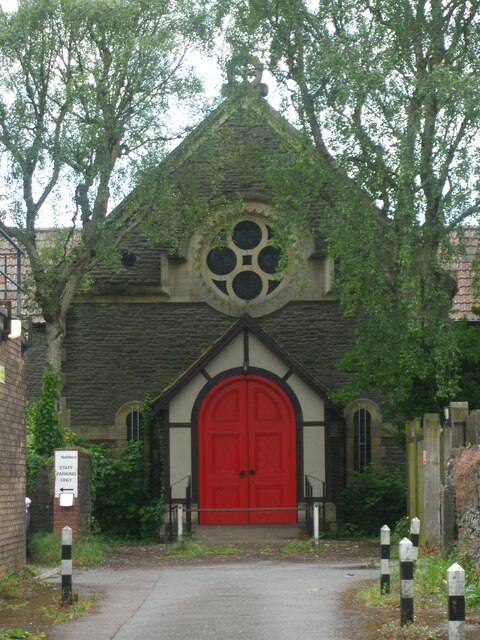
Image: © Neil Owen Taken: 29 May 2024
Like others on the main road in Kingswood, this church is set back and approached by a short pathway. It remains encircled by businesses and houses, but was originally a Moravian Chapel. One of the first Protestant factions that was officially recognised, the church found lots of support in this predominantly working class area - mainly colliers. Along with Methodism, which has the Whitfield Tabernacle just up the road, the various new approaches to worship eventually combined.
Images are licensed for reuse under creativecommons.org/licenses/by-sa/2.0
Image Location


Leaflet Map data © OpenStreetMap
Latitude
51.461983
Longitude
-2.507492