The promenade, Penrhyn Bay
Introduction
The photograph on this page of The promenade, Penrhyn Bay by Alan Murray-Rust as part of the Geograph project.
The Geograph project started in 2005 with the aim of publishing, organising and preserving representative images for every square kilometre of Great Britain, Ireland and the Isle of Man.

There are currently over 7.5m images from over 14,400 individuals and you can help contribute to the project by visiting https://www.geograph.org.uk
The promenade, Penrhyn Bay
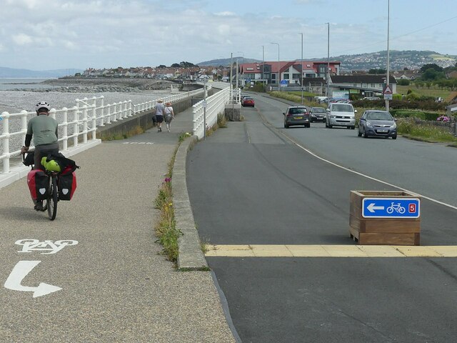
Image: © Alan Murray-Rust Taken: 22 Jun 2024
National Cycle Route 5 joins the pedestrian way along this section, which also forms part of the North Wales Coastal Path. The promenade was created by the Llandudno and Colwyn Bay Electric Railway to carry their tramway and was a private toll road. Damage caused during storms in the early 1950s was a factor in the demise of the tramway. The sea defences, which as can be seen are significantly higher than the roadway, only appeared much later.
Images are licensed for reuse under creativecommons.org/licenses/by-sa/2.0
Image Location
Latitude
53.318016
Longitude
-3.762772