The Public Footpath on Platform 1
Introduction
The photograph on this page of The Public Footpath on Platform 1 by Des Blenkinsopp as part of the Geograph project.
The Geograph project started in 2005 with the aim of publishing, organising and preserving representative images for every square kilometre of Great Britain, Ireland and the Isle of Man.

There are currently over 7.5m images from over 14,400 individuals and you can help contribute to the project by visiting https://www.geograph.org.uk
The Public Footpath on Platform 1
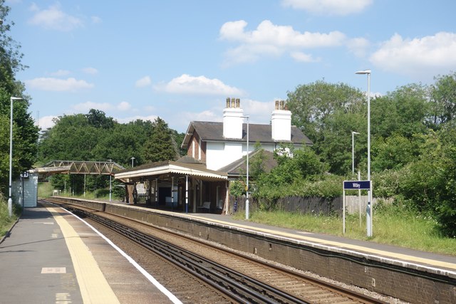
Image: © Des Blenkinsopp Taken: 26 Jun 2024
Train companies are not usually too keen on random people wandering about on railway property, but Witley Station's platform 1 is a public right of way. A look at the map shows why. A footpath heading north - south looks like it used to cross the line just past the end of the station, presumably at a level crossing of some sort. Not all trains stop at Witley, so some are going fast through here. A safer option has been to divert the path along the platform to cross the line at the footbridge. Once across, the path rejoins the original route via the station forecourt.
Images are licensed for reuse under creativecommons.org/licenses/by-sa/2.0
Image Location
Latitude
51.132897
Longitude
-0.646362