Loughor Estuary from the air, 1998
Introduction
The photograph on this page of Loughor Estuary from the air, 1998 by Derek Harper as part of the Geograph project.
The Geograph project started in 2005 with the aim of publishing, organising and preserving representative images for every square kilometre of Great Britain, Ireland and the Isle of Man.

There are currently over 7.5m images from over 14,400 individuals and you can help contribute to the project by visiting https://www.geograph.org.uk
Loughor Estuary from the air, 1998
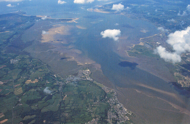
Image: © Derek Harper Taken: 1 Jun 1998
In the centre is Crofty; below to the right is Penclawdd. On the right bank is Llanelli. The Loughor reaches the sea past Whiteford Point, the spit on the left. Beyond it on the right is/are Pembrey Burrows.
Images are licensed for reuse under creativecommons.org/licenses/by-sa/2.0
Image Location
Latitude
51.639754
Longitude
-4.135834