Gomersal Parish Church
Introduction
The photograph on this page of Gomersal Parish Church by David Grimshaw as part of the Geograph project.
The Geograph project started in 2005 with the aim of publishing, organising and preserving representative images for every square kilometre of Great Britain, Ireland and the Isle of Man.

There are currently over 7.5m images from over 14,400 individuals and you can help contribute to the project by visiting https://www.geograph.org.uk
Gomersal Parish Church
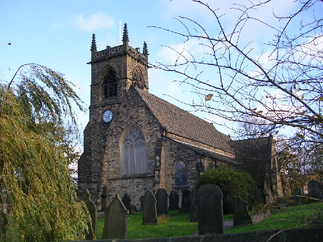
Image: © David Grimshaw Taken: 12 Nov 2005
The church of St. Mary's stands proud at the top of Spen Lane, Gomersal, and can be seen for several miles from the north west. Opposite the church now a house building site used to be Thomas Burnley and Sons, worsted spinners and combers, where I worked for many years.
Images are licensed for reuse under creativecommons.org/licenses/by-sa/2.0
Image Location


Leaflet Map data © OpenStreetMap
Latitude
53.728906
Longitude
-1.689413