Crooked houses, Carlton Road
Introduction
The photograph on this page of Crooked houses, Carlton Road by Alan Murray-Rust as part of the Geograph project.
The Geograph project started in 2005 with the aim of publishing, organising and preserving representative images for every square kilometre of Great Britain, Ireland and the Isle of Man.

There are currently over 7.5m images from over 14,400 individuals and you can help contribute to the project by visiting https://www.geograph.org.uk
Crooked houses, Carlton Road
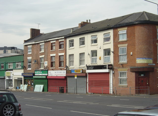
Image: © Alan Murray-Rust Taken: 27 Apr 2008
Although there were collieries close to Nottingham, this part of the City was unlikely to have been affected. This is the only group of buildings in the area to have suffered this extent of distortion which is probably simply the result of inadequate building standards. They have been refurbished significantly in the last few years as a result of the demand for student accommodation.
Images are licensed for reuse under creativecommons.org/licenses/by-sa/2.0
Image Location
Latitude
52.954332
Longitude
-1.137085