Flood defences at Cummersdale Mills
Introduction
The photograph on this page of Flood defences at Cummersdale Mills by Christine Johnstone as part of the Geograph project.
The Geograph project started in 2005 with the aim of publishing, organising and preserving representative images for every square kilometre of Great Britain, Ireland and the Isle of Man.

There are currently over 7.5m images from over 14,400 individuals and you can help contribute to the project by visiting https://www.geograph.org.uk
Flood defences at Cummersdale Mills
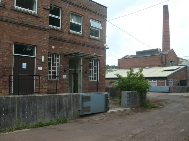
Image: © Christine Johnstone Taken: 13 Jun 2024
A low wall fitted with grey flood gates. The textile printing and dying business [now Stead McAlpin] has been here alongside the River Caldew since 1835. Originally the mill would have been water-powered and later, steam. The River Caldew flows north from the northern flanks of Skiddaw and is prone to flooding. It is a tributary of the River Eden.
Images are licensed for reuse under creativecommons.org/licenses/by-sa/2.0
Image Location
Latitude
54.86944
Longitude
-2.945012