WW2 pillbox overlooking the River Gavenny
Introduction
The photograph on this page of WW2 pillbox overlooking the River Gavenny by Roger Davies as part of the Geograph project.
The Geograph project started in 2005 with the aim of publishing, organising and preserving representative images for every square kilometre of Great Britain, Ireland and the Isle of Man.

There are currently over 7.5m images from over 14,400 individuals and you can help contribute to the project by visiting https://www.geograph.org.uk
WW2 pillbox overlooking the River Gavenny
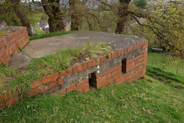
Image: © Roger Davies Taken: 27 Apr 2008
View looks south-westwards. This is a variant pillbox in a commanding position near the road bridge carrying the B4521 over the River Gavenny near Abergavenny. The embrasures indicate it was designed to repel an attacking force from the north. Presumably this pillbox formed part of the 'Usk Stopline' defences constructed in 1940-41 (the river Usk flows through Abergavenny some 1.5 miles to the south).
Images are licensed for reuse under creativecommons.org/licenses/by-sa/2.0
Image Location
Latitude
51.830136
Longitude
-3.003707