Local Centre, Leigh Park, Westbury
Introduction
The photograph on this page of Local Centre, Leigh Park, Westbury by Phil Williams as part of the Geograph project.
The Geograph project started in 2005 with the aim of publishing, organising and preserving representative images for every square kilometre of Great Britain, Ireland and the Isle of Man.

There are currently over 7.5m images from over 14,400 individuals and you can help contribute to the project by visiting https://www.geograph.org.uk
Local Centre, Leigh Park, Westbury
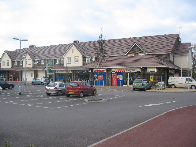
Image: © Phil Williams Taken: 13 Nov 2005
This is the parade of shops at Leigh Park Local Centre, part of the Leigh Park development, a new neighbourhood next to Westbury Leigh in Westbury. The road is called Palamino Place. Leigh Park Community Centre, Leigh Park Doctors' Surgery and Leigh Park Community Nursery are expected to be built on adjacent land to the right of the shop shortly. Together with the shops, these buildings form Leigh Park Local Centre.
Images are licensed for reuse under creativecommons.org/licenses/by-sa/2.0
Image Location


Leaflet Map data © OpenStreetMap
Latitude
51.253504
Longitude
-2.194825