
Clarendon House, Belfast
Introduction
The photograph on this page of Clarendon House, Belfast by Albert Bridge as part of the Geograph project.
The Geograph project started in 2005 with the aim of publishing, organising and preserving representative images for every square kilometre of Great Britain, Ireland and the Isle of Man.

There are currently over 7.5m images from over 14,400 individuals and you can help contribute to the project by visiting https://www.geograph.org.uk
Clarendon House, Belfast
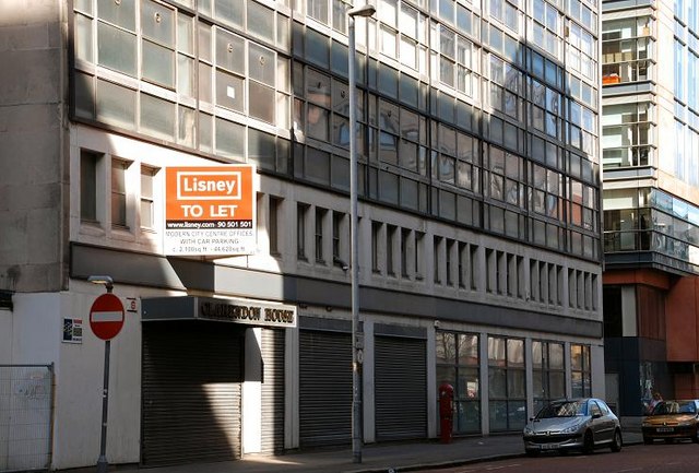
Image: © Albert Bridge Taken: 27 Apr 2008
Clarendon House (at the corner of Adelaide Street and Franklin Street) began life circa 1970 as the “Silopark” – a multi-storey car park using lifts instead of the now-predominant spiral system. It soon fell victim to an internal car bomb and lay derelict for many years before conversion to an office building. Planning permission has now been sought for a replacement block of eleven storeys. The architect’s drawing shows something more pleasing to the eye. A visitor to the site has supplied some information which confirms that the lifts were maintained in working order for some time after the bomb. The building’s owner became the subject of a corporate insolvency in early 2011.
Images are licensed for reuse under creativecommons.org/licenses/by-sa/2.0
Image Location

Latitude
54.595056
Longitude
-5.92895