Old milestone
Introduction
The photograph on this page of Old milestone by Chris Minto as part of the Geograph project.
The Geograph project started in 2005 with the aim of publishing, organising and preserving representative images for every square kilometre of Great Britain, Ireland and the Isle of Man.

There are currently over 7.5m images from over 14,400 individuals and you can help contribute to the project by visiting https://www.geograph.org.uk
Old milestone
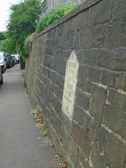
Image: © Chris Minto Taken: 25 May 2024
This shows how high the milestone on the A646 in Luddendenfoot is set in the wall. There are several others of this design on this road towards Todmorden, also on Rochdale Road A6033 southwards and Burnley Road A646 northwest out of Todmorden. They may have been set up by the Todmorden Trust which was set up in 1771 and covered 16.8 miles or the Halifax, Sowerby Bridge, Todmorden Trust of 1760. There is faint cut benchmark on the stone below the milestone. Grade II listed 1134554.
Images are licensed for reuse under creativecommons.org/licenses/by-sa/2.0
Image Location
Latitude
53.716899
Longitude
-1.941019