Painswick Road Crossing
Introduction
The photograph on this page of Painswick Road Crossing by David Stowell as part of the Geograph project.
The Geograph project started in 2005 with the aim of publishing, organising and preserving representative images for every square kilometre of Great Britain, Ireland and the Isle of Man.

There are currently over 7.5m images from over 14,400 individuals and you can help contribute to the project by visiting https://www.geograph.org.uk
Painswick Road Crossing
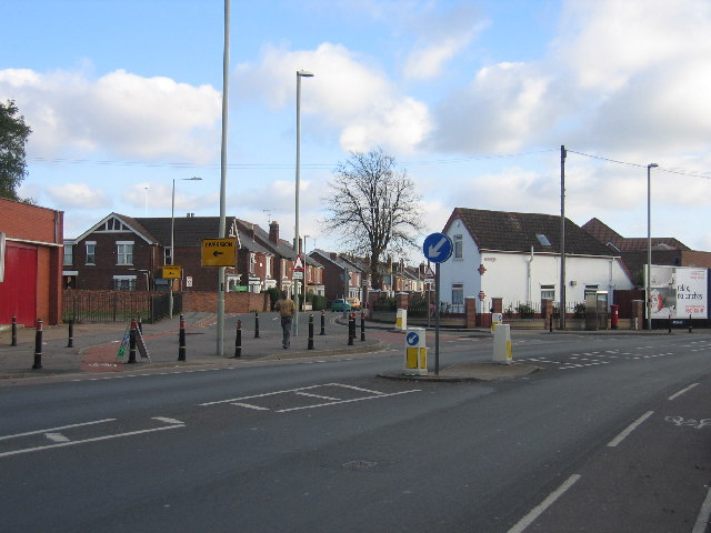
Image: © David Stowell Taken: 13 Nov 2005
This view, looking east from Stroud Road at the junction with Tredworth Road show the site of the level crossing with former Midland Railway line through Gloucester. This line was plagued with a succession of level crossings and was eventually closed in the 1970s. All that can be seen today is the slight rise in the road (just the right of the further "diversion" sign) and the former railway cottage (the white building to the right of the picture). Compare with Image and Image
Images are licensed for reuse under creativecommons.org/licenses/by-sa/2.0
Image Location


Leaflet Map data © OpenStreetMap
Latitude
51.853138
Longitude
-2.243866