The Nags Head
Introduction
The photograph on this page of The Nags Head by Bill Nicholls as part of the Geograph project.
The Geograph project started in 2005 with the aim of publishing, organising and preserving representative images for every square kilometre of Great Britain, Ireland and the Isle of Man.

There are currently over 7.5m images from over 14,400 individuals and you can help contribute to the project by visiting https://www.geograph.org.uk
The Nags Head
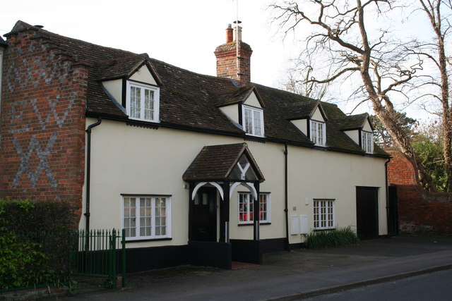
Image: © Bill Nicholls Taken: 26 Apr 2008
Been waiting to get a shot of this place for a while. It's the Nags Head which shut in the 1950s I think, though I do remember it being open when I was a child. The house has been extended in recent years. I seem to remember reading it was also a toll house as the Reading road was a toll road in the distant past.
Images are licensed for reuse under creativecommons.org/licenses/by-sa/2.0
Image Location
Latitude
51.592457
Longitude
-1.126315