Long field at Little Allington
Introduction
The photograph on this page of Long field at Little Allington by Stephen Craven as part of the Geograph project.
The Geograph project started in 2005 with the aim of publishing, organising and preserving representative images for every square kilometre of Great Britain, Ireland and the Isle of Man.

There are currently over 7.5m images from over 14,400 individuals and you can help contribute to the project by visiting https://www.geograph.org.uk
Long field at Little Allington
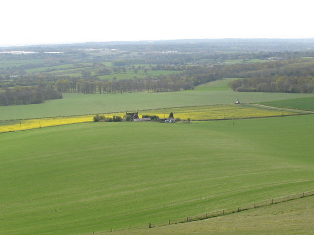
Image: © Stephen Craven Taken: 26 Apr 2008
The feature of interest here is not so much the farm buildings in the centre, as the way that the ploughing pattern still evident in the short growth of the crop accentuates the undulating ground along the length of the field. A boundary wall or fence shown on earlier 1:25,000 maps has been removed, making the whole field about 1km long (the extent of it is not clear on this photo).
Images are licensed for reuse under creativecommons.org/licenses/by-sa/2.0
Image Location
Latitude
51.271624
Longitude
0.637106