Old Bridge Marker on the B3254 in Liskeard
Introduction
The photograph on this page of Old Bridge Marker on the B3254 in Liskeard by P Barnett as part of the Geograph project.
The Geograph project started in 2005 with the aim of publishing, organising and preserving representative images for every square kilometre of Great Britain, Ireland and the Isle of Man.

There are currently over 7.5m images from over 14,400 individuals and you can help contribute to the project by visiting https://www.geograph.org.uk
Old Bridge Marker on the B3254 in Liskeard
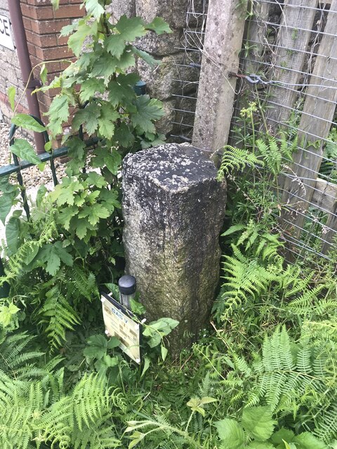
Image: © P Barnett Taken: 22 May 2024
Bridge Marker between the end of the parapet of the railway viaduct and no.1 Turnpike Place on the west side of the B3254. Liskeard parish. It is assumed that the stone marks the division of responsibility for maintenance of the road and viaduct between the county council and the railway company. Milestone Society National ID: CW_LISK03br
Images are licensed for reuse under creativecommons.org/licenses/by-sa/2.0
Image Location
Latitude
50.447021
Longitude
-4.470583