The Hawthorn Inn
Introduction
The photograph on this page of The Hawthorn Inn by Bob Embleton as part of the Geograph project.
The Geograph project started in 2005 with the aim of publishing, organising and preserving representative images for every square kilometre of Great Britain, Ireland and the Isle of Man.

There are currently over 7.5m images from over 14,400 individuals and you can help contribute to the project by visiting https://www.geograph.org.uk
The Hawthorn Inn
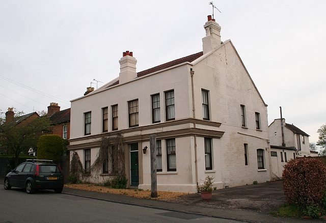
Image: © Bob Embleton Taken: 26 Apr 2008
Now closed. The only pub in the village of Upper Welland. Used to be a well renowned restaurant. Built, as were most of the houses in the village, on land that had been part of Lower Assart or Assarts Common. The common land was enclosed after the 1851 Welland Inclosure Act which stipulated how each new field boundary must be planted with hawthorn hedges. It is thought that that is how the Inn got its name.
Images are licensed for reuse under creativecommons.org/licenses/by-sa/2.0
Image Location
Latitude
52.06585
Longitude
-2.322776