Wine trail?
Introduction
The photograph on this page of Wine trail? by David M Clark as part of the Geograph project.
The Geograph project started in 2005 with the aim of publishing, organising and preserving representative images for every square kilometre of Great Britain, Ireland and the Isle of Man.

There are currently over 7.5m images from over 14,400 individuals and you can help contribute to the project by visiting https://www.geograph.org.uk
Wine trail?
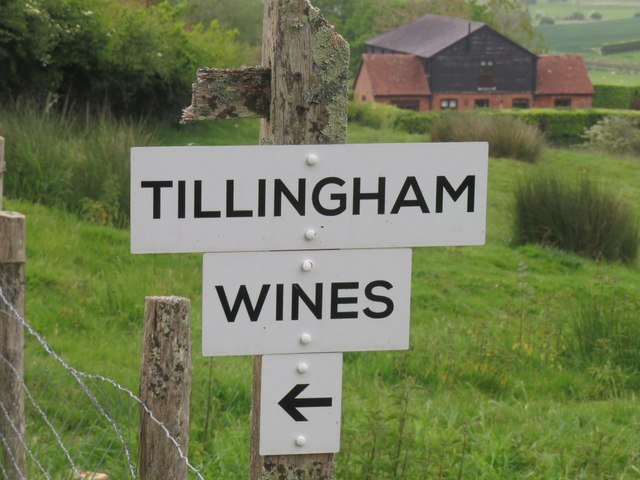
Image: © David M Clark Taken: 13 May 2024
Riders and walkers might just miss the rather battered bridleway sign above Wick Farm, but they can't miss the markers to Tillingham Wines that follow the way.
Images are licensed for reuse under creativecommons.org/licenses/by-sa/2.0
Image Location


Leaflet Map data © OpenStreetMap
Latitude
50.943281
Longitude
0.68311