Blackmoorfoot Road, Crosland Hill, Lockwood
Introduction
The photograph on this page of Blackmoorfoot Road, Crosland Hill, Lockwood by Humphrey Bolton as part of the Geograph project.
The Geograph project started in 2005 with the aim of publishing, organising and preserving representative images for every square kilometre of Great Britain, Ireland and the Isle of Man.

There are currently over 7.5m images from over 14,400 individuals and you can help contribute to the project by visiting https://www.geograph.org.uk
Blackmoorfoot Road, Crosland Hill, Lockwood
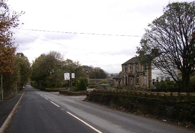
Image: © Humphrey Bolton Taken: 11 Nov 2005
This used to be called Manchester Old Road, and is a long, evenly graded climb, probably straightened when it was improved as a turnpike road (the Wakefield and Austerfields Trust) in 1759. This road continues to Marsden and Standedge, but was replaced by the road that became the A62 in the early 19C. Out of sight on the left is the Standard (now Black Cat), fireworks factory. The pub is the Sands House and the road to the right Sands House Lane.
Images are licensed for reuse under creativecommons.org/licenses/by-sa/2.0
Image Location


Leaflet Map data © OpenStreetMap
Latitude
53.62601
Longitude
-1.827594