Under the M32
Introduction
The photograph on this page of Under the M32 by Neil Owen as part of the Geograph project.
The Geograph project started in 2005 with the aim of publishing, organising and preserving representative images for every square kilometre of Great Britain, Ireland and the Isle of Man.

There are currently over 7.5m images from over 14,400 individuals and you can help contribute to the project by visiting https://www.geograph.org.uk
Under the M32
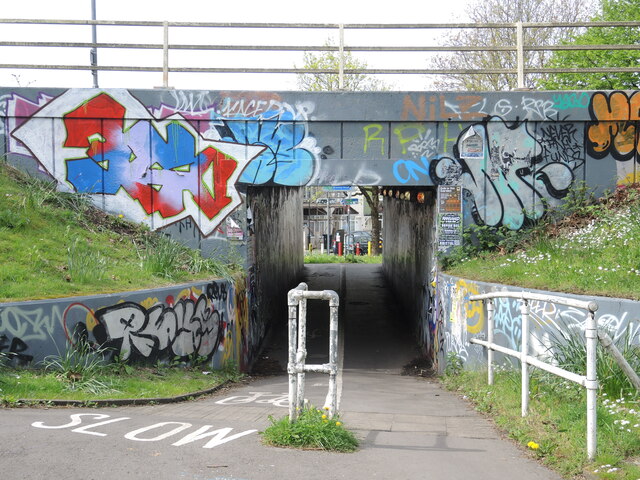
Image: © Neil Owen Taken: 12 Apr 2024
The M32 was built in the 1970s and took out a lot of old housing. Now the main roundabout (J3) is accessible on foot or cycle, with this a view from the inside out towards the Lower Ashley Road. Naturally, the locals have made it a part of their neighbourhood.
Images are licensed for reuse under creativecommons.org/licenses/by-sa/2.0
Image Location
Latitude
51.465983
Longitude
-2.576059