The Manor House
Introduction
The photograph on this page of The Manor House by Gordon Hatton as part of the Geograph project.
The Geograph project started in 2005 with the aim of publishing, organising and preserving representative images for every square kilometre of Great Britain, Ireland and the Isle of Man.

There are currently over 7.5m images from over 14,400 individuals and you can help contribute to the project by visiting https://www.geograph.org.uk
The Manor House
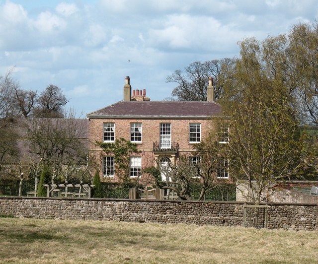
Image: © Gordon Hatton Taken: 24 Apr 2008
The style of this handsome house would suggest a construction date of about 1820. The problem is trying to establish the correct square, as both scales of OS map label the house in the adjoining square. The house itself appears to be right on the grid line.
Images are licensed for reuse under creativecommons.org/licenses/by-sa/2.0
Image Location


Leaflet Map data © OpenStreetMap
Latitude
54.129657
Longitude
-1.43529