Barnoldswick's oldest mill
Introduction
The photograph on this page of Barnoldswick's oldest mill by Dr Neil Clifton as part of the Geograph project.
The Geograph project started in 2005 with the aim of publishing, organising and preserving representative images for every square kilometre of Great Britain, Ireland and the Isle of Man.

There are currently over 7.5m images from over 14,400 individuals and you can help contribute to the project by visiting https://www.geograph.org.uk
Barnoldswick's oldest mill
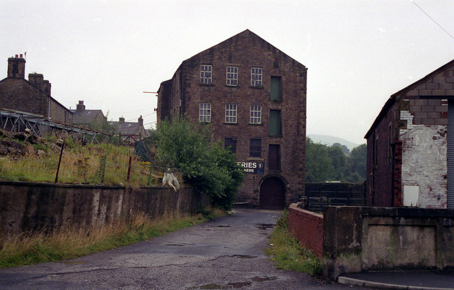
Image: © Dr Neil Clifton Taken: 9 Aug 1992
See Image Another photograph showing the old corn mill from the other end, before new building obscured the view.
Images are licensed for reuse under creativecommons.org/licenses/by-sa/2.0
Image Location
Latitude
53.920791
Longitude
-2.18877