Ram Inn, Potters Pond, Wotton under Edge
Introduction
The photograph on this page of Ram Inn, Potters Pond, Wotton under Edge by Brian Robert Marshall as part of the Geograph project.
The Geograph project started in 2005 with the aim of publishing, organising and preserving representative images for every square kilometre of Great Britain, Ireland and the Isle of Man.

There are currently over 7.5m images from over 14,400 individuals and you can help contribute to the project by visiting https://www.geograph.org.uk
Ram Inn, Potters Pond, Wotton under Edge
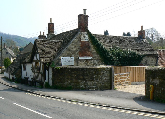
Image: © Brian Robert Marshall Taken: 22 Apr 2008
The old inn looks as if it has been abandoned. Not so. It has a long and interesting history dating back to the 13th or 14th century, or possibly earlier. The property is owned and occupied by a fascinating old gentleman who purchased it from a brewery in 1968 for £2600. It is said to be haunted by a variety of ghosts, was a haunt of highwaymen and has connections to the local parish church. The owner invited me in to take a look around, something he does with everyone who shows an interest in the place. Despite the auras within the building that reportedly interfere with modern electronics, I was able successfully to obtain a number of images from within the place. The interiors reminded me of Snowshill Manor, a National Trust property stuffed with artefacts from a lifetime's collection. The Ram Inn is not quite so grand or so organised but it is chockablock with old fowling pieces, stuffed animals, clocks, a ship's wheel, an insurance mark, paintings, carvings, furniture, bric a brac and some motorbikes. Structurally the building is in a poor state. It is listed Grade II* http://www.imagesofengland.org.uk/details/default.aspx?id=128232 but I couldn't find it on the Buildings at Risk register. Next image http://www.geograph.org.uk/photo/775521 Diversion to interior http://www.geograph.org.uk/photo/779809
Images are licensed for reuse under creativecommons.org/licenses/by-sa/2.0
Image Location


Leaflet Map data © OpenStreetMap
Latitude
51.637899
Longitude
-2.347904