Old milestone
Introduction
The photograph on this page of Old milestone by Jon Glew as part of the Geograph project.
The Geograph project started in 2005 with the aim of publishing, organising and preserving representative images for every square kilometre of Great Britain, Ireland and the Isle of Man.

There are currently over 7.5m images from over 14,400 individuals and you can help contribute to the project by visiting https://www.geograph.org.uk
Old milestone
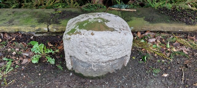
Image: © Jon Glew Taken: 6 Apr 2024
The first milestone on the A710 out of Dumfries towards Moffat near Milehouse Crescent. A 1980s photo shows it twice this height so the path has been built up since then. The recess for a plate can just be seen. The plate would have read EDINBURGH/arrow to left 71/DUMFRIES/1 arrow to right. The plate would have been cast at the Affleck Foundry in the early 1800s. There is a benchmark and pin in the bare patch on the top.
Images are licensed for reuse under creativecommons.org/licenses/by-sa/2.0
Image Location
Latitude
55.081889
Longitude
-3.59841