Llanfair Orllwyn
Introduction
The photograph on this page of Llanfair Orllwyn by Marion Phillips as part of the Geograph project.
The Geograph project started in 2005 with the aim of publishing, organising and preserving representative images for every square kilometre of Great Britain, Ireland and the Isle of Man.

There are currently over 7.5m images from over 14,400 individuals and you can help contribute to the project by visiting https://www.geograph.org.uk
Llanfair Orllwyn
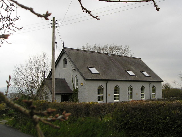
Image: © Marion Phillips Taken: 20 Apr 2008
On my older edition of the Ordnance Survey map this house is marked by a cross indicating a religious building. I think it was the church hall as there is a church of the same name half a mile to the south. This building is now used as a dwelling house.
Images are licensed for reuse under creativecommons.org/licenses/by-sa/2.0
Image Location
Latitude
52.048835
Longitude
-4.383398