
Coleorton Moor, looking south towards Pitt Lane
Introduction
The photograph on this page of Coleorton Moor, looking south towards Pitt Lane by Robert Haywood as part of the Geograph project.
The Geograph project started in 2005 with the aim of publishing, organising and preserving representative images for every square kilometre of Great Britain, Ireland and the Isle of Man.

There are currently over 7.5m images from over 14,400 individuals and you can help contribute to the project by visiting https://www.geograph.org.uk
Coleorton Moor, looking south towards Pitt Lane
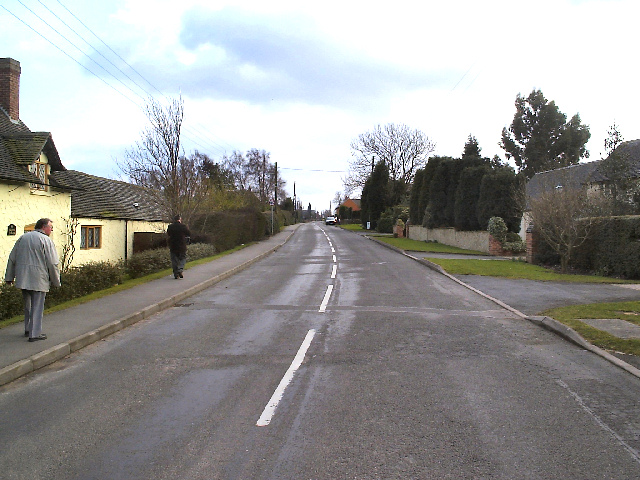
Image: © Robert Haywood Taken: Unknown
Coleorton Moor, looking south from near The Angel Inn, with Pilgrim Cottage on the left, up towards Pitt Lane a couple of hundred yards up on the right. Going on past Pitt Lane, the Moor itself leads on to Sinope and the curiously named Botany Bay. The whole area of Coleorton, and particularly in the village itself, is literally festooned with public footpaths that criss-cross the surrounding fields enough to show the red-dotted lines quite densely on Ordnance Survey maps.
Images are licensed for reuse under creativecommons.org/licenses/by-sa/2.0
Image Location

Latitude
52.745356
Longitude
-1.406234