Rochester Castle, Rochester, Kent
Introduction
The photograph on this page of Rochester Castle, Rochester, Kent by Christine Matthews as part of the Geograph project.
The Geograph project started in 2005 with the aim of publishing, organising and preserving representative images for every square kilometre of Great Britain, Ireland and the Isle of Man.

There are currently over 7.5m images from over 14,400 individuals and you can help contribute to the project by visiting https://www.geograph.org.uk
Rochester Castle, Rochester, Kent
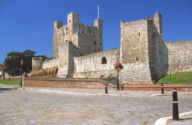
Image: © Christine Matthews Taken: Unknown
The first castle was raised here at the time of the Norman Conquest and is mentioned in the Domesday Book in 1086. This early fortification was rebuilt for King William Rufus between 1087-89 by Gundulf, Bishop of Rochester, and was one of the earliest castles in this country to be fortified in stone. Much of the documentation on Rochester survives, along with the many dramatic details of its military history - which saw the castle suffer three major sieges within two centuries of its foundation.
Images are licensed for reuse under creativecommons.org/licenses/by-sa/2.0
Image Location


Leaflet Map data © OpenStreetMap
Latitude
51.388742
Longitude
0.500955