Former stables, Church Road, Liverpool
Introduction
The photograph on this page of Former stables, Church Road, Liverpool by Stephen Richards as part of the Geograph project.
The Geograph project started in 2005 with the aim of publishing, organising and preserving representative images for every square kilometre of Great Britain, Ireland and the Isle of Man.

There are currently over 7.5m images from over 14,400 individuals and you can help contribute to the project by visiting https://www.geograph.org.uk
Former stables, Church Road, Liverpool
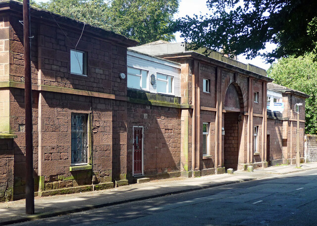
Image: © Stephen Richards Taken: 16 Aug 2016
Formerly attached to Knolle Park and dating from the 1820s. Arched centrepiece, now flanked by "hideous" additions inexplicably permitted when the building was converted to housing. Grade II listed.
Images are licensed for reuse under creativecommons.org/licenses/by-sa/2.0
Image Location
Latitude
53.381055
Longitude
-2.873994