Solent View
Introduction
The photograph on this page of Solent View by Ian Capper as part of the Geograph project.
The Geograph project started in 2005 with the aim of publishing, organising and preserving representative images for every square kilometre of Great Britain, Ireland and the Isle of Man.

There are currently over 7.5m images from over 14,400 individuals and you can help contribute to the project by visiting https://www.geograph.org.uk
Solent View
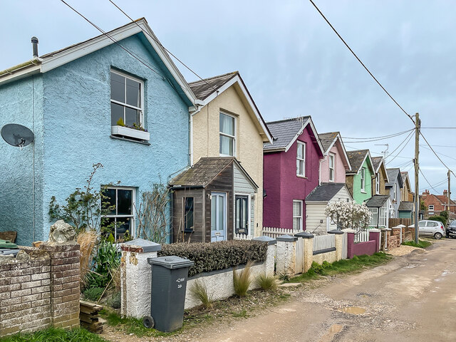
Image: © Ian Capper Taken: 30 Mar 2023
Group of 8 houses in Queen's Road. Although similar looking, the far 6 were built first, being marked on the 1908 25" map; the nearest pair, nos 7 & 8, were later, not shown until the 1946 edition.
Images are licensed for reuse under creativecommons.org/licenses/by-sa/2.0
Image Location
Latitude
50.688137
Longitude
-1.087963