The Caldew Cycleway and The Cumbria Way
Introduction
The photograph on this page of The Caldew Cycleway and The Cumbria Way by Adrian Taylor as part of the Geograph project.
The Geograph project started in 2005 with the aim of publishing, organising and preserving representative images for every square kilometre of Great Britain, Ireland and the Isle of Man.

There are currently over 7.5m images from over 14,400 individuals and you can help contribute to the project by visiting https://www.geograph.org.uk
The Caldew Cycleway and The Cumbria Way
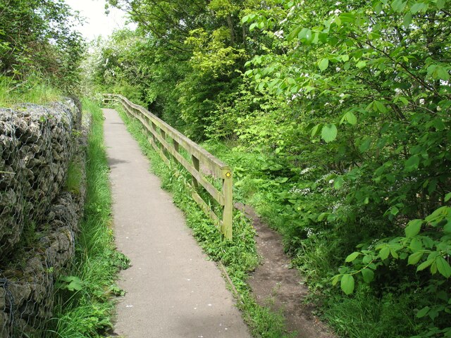
Image: © Adrian Taylor Taken: 14 May 2014
The Caldew Cycleway and The Cumbria Way follow the same route northwards from Dalston, finally separating here north of the Stead McAlpin Printing Works at Cummersdale Mills. The cycleway climbs the ramp and provides an alternative route to The Cumbria Way between here and Denton Holme; The Cumbria Way itself follows the narrow public footpath to the right of the wooden railings (next photograph Image).
Images are licensed for reuse under creativecommons.org/licenses/by-sa/2.0
Image Location
Latitude
54.870777
Longitude
-2.946445