East side of an early 18th century house, Staunton, Gloucestershire
Introduction
The photograph on this page of East side of an early 18th century house, Staunton, Gloucestershire by Jaggery as part of the Geograph project.
The Geograph project started in 2005 with the aim of publishing, organising and preserving representative images for every square kilometre of Great Britain, Ireland and the Isle of Man.

There are currently over 7.5m images from over 14,400 individuals and you can help contribute to the project by visiting https://www.geograph.org.uk
East side of an early 18th century house, Staunton, Gloucestershire
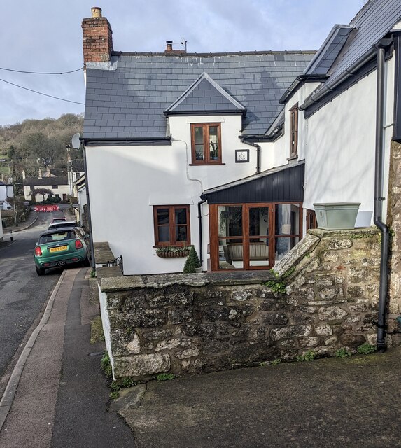
Image: © Jaggery Taken: 25 Feb 2024
The rectangular tablet https://www.geograph.org.uk/photo/7716958 alongside the first floor window shows the year 1719
Images are licensed for reuse under creativecommons.org/licenses/by-sa/2.0
Image Location
Latitude
51.810118
Longitude
-2.654993