High Street
Introduction
The photograph on this page of High Street by Simon Carey as part of the Geograph project.
The Geograph project started in 2005 with the aim of publishing, organising and preserving representative images for every square kilometre of Great Britain, Ireland and the Isle of Man.

There are currently over 7.5m images from over 14,400 individuals and you can help contribute to the project by visiting https://www.geograph.org.uk
High Street
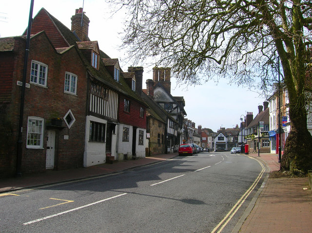
Image: © Simon Carey Taken: 20 Apr 2008
The eastern approach to the old Wealden market town's main street which was laid out in the 13th century. The main buildings in view are the Old Lockup a former 19th century police station and Porch House a 16th century cottage followed by the 15th century Cromwell House. In the distance the wide street has had shops built in the middle probably on older market plots.
Images are licensed for reuse under creativecommons.org/licenses/by-sa/2.0
Image Location
Latitude
51.123731
Longitude
-0.006005