OS benchmark - Shrewsbury, 4 Preston Street
Introduction
The photograph on this page of OS benchmark - Shrewsbury, 4 Preston Street by Richard Law as part of the Geograph project.
The Geograph project started in 2005 with the aim of publishing, organising and preserving representative images for every square kilometre of Great Britain, Ireland and the Isle of Man.

There are currently over 7.5m images from over 14,400 individuals and you can help contribute to the project by visiting https://www.geograph.org.uk
OS benchmark - Shrewsbury, 4 Preston Street
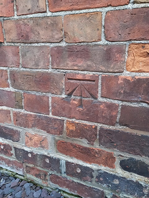
Image: © Richard Law Taken: 17 Feb 2024
The same mark as Image, but seen from a slightly different angle. By its size and style, the benchmark looks to have been originally cut in the late 19th century, probably as part of the First Geodetic Levelling of England and Wales; it appears on the map of 1901 at 223.2ft Liverpool datum, but was last levelled by the OS in 1967 at 67.94m Ordnance Datum Newlyn.
Images are licensed for reuse under creativecommons.org/licenses/by-sa/2.0
Image Location
Latitude
52.704223
Longitude
-2.730907