Very narrow stretch of Sutton Rise above Ogmore-by-Sea
Introduction
The photograph on this page of Very narrow stretch of Sutton Rise above Ogmore-by-Sea by eswales as part of the Geograph project.
The Geograph project started in 2005 with the aim of publishing, organising and preserving representative images for every square kilometre of Great Britain, Ireland and the Isle of Man.

There are currently over 7.5m images from over 14,400 individuals and you can help contribute to the project by visiting https://www.geograph.org.uk
Very narrow stretch of Sutton Rise above Ogmore-by-Sea
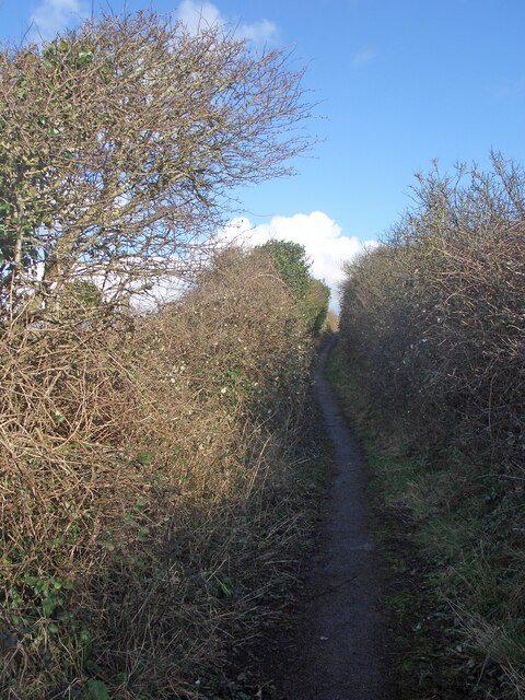
Image: © eswales Taken: 12 Feb 2024
Vehicles have for many years been prohibited from using much of the route between Ogmore-by-Sea and Norton called Sutton Rise, including the stretch seen here. Despite much of it now being just a path, the route is still shown as a lane on Ordnance Survey and other maps. This is its narrowest stretch. It would surely have been wider when vehicles were permitted, and have subsequently narrowed due to the encroachment of vegetation.
Images are licensed for reuse under creativecommons.org/licenses/by-sa/2.0
Image Location
Latitude
51.467072
Longitude
-3.632554