Godley Hill (fold)
Introduction
The photograph on this page of Godley Hill (fold) by Stephen Burton as part of the Geograph project.
The Geograph project started in 2005 with the aim of publishing, organising and preserving representative images for every square kilometre of Great Britain, Ireland and the Isle of Man.

There are currently over 7.5m images from over 14,400 individuals and you can help contribute to the project by visiting https://www.geograph.org.uk
Godley Hill (fold)
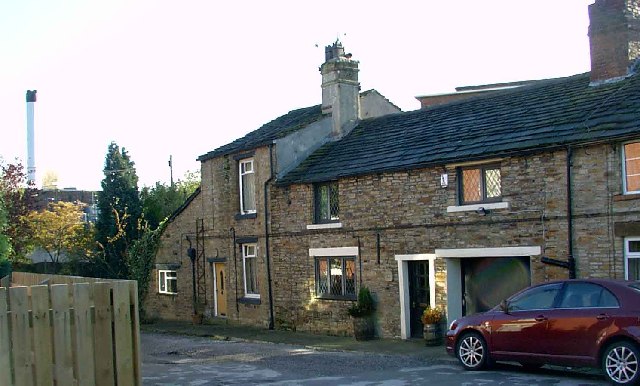
Image: © Stephen Burton Taken: 12 Nov 2005
One of the oldest settlements in the Hyde area. The building in the distance is the Kerry Foods works (it was originally Walls).
Images are licensed for reuse under creativecommons.org/licenses/by-sa/2.0
Image Location


Leaflet Map data © OpenStreetMap
Latitude
53.45085
Longitude
-2.051157