Glynricked Fawr
Introduction
The photograph on this page of Glynricked Fawr by Marion Phillips as part of the Geograph project.
The Geograph project started in 2005 with the aim of publishing, organising and preserving representative images for every square kilometre of Great Britain, Ireland and the Isle of Man.

There are currently over 7.5m images from over 14,400 individuals and you can help contribute to the project by visiting https://www.geograph.org.uk
Glynricked Fawr
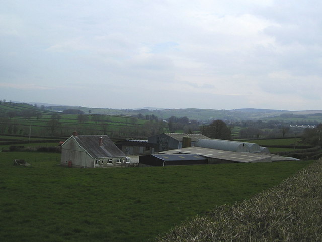
Image: © Marion Phillips Taken: 18 Apr 2008
This is a typical livestock farm found in this area. Buildings to house animals and machinery can be seen on either side of the barns. the hedged fields are quite small with scattered trees. The hills forming part of Mynydd Llanybydder can be seen in the distance.
Images are licensed for reuse under creativecommons.org/licenses/by-sa/2.0
Image Location


Leaflet Map data © OpenStreetMap
Latitude
52.040472
Longitude
-4.212926