Road Bridge
Introduction
The photograph on this page of Road Bridge by Marion Phillips as part of the Geograph project.
The Geograph project started in 2005 with the aim of publishing, organising and preserving representative images for every square kilometre of Great Britain, Ireland and the Isle of Man.

There are currently over 7.5m images from over 14,400 individuals and you can help contribute to the project by visiting https://www.geograph.org.uk
Road Bridge
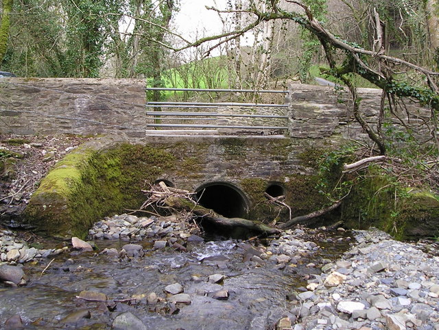
Image: © Marion Phillips Taken: 18 Apr 2008
Even a short stream like this can swell dramatically in prolonged wet weather. Logs, boulders and stones get washed downstream and could block the tubular channel under the road. The resulting dammed-up water could cause the bridge to be washed away so the designers have replaced the stone parapets with metal bars on each side of the road.
Images are licensed for reuse under creativecommons.org/licenses/by-sa/2.0
Image Location


Leaflet Map data © OpenStreetMap
Latitude
52.035701
Longitude
-4.232228