Sunken Lane
Introduction
The photograph on this page of Sunken Lane by Simon Huguet as part of the Geograph project.
The Geograph project started in 2005 with the aim of publishing, organising and preserving representative images for every square kilometre of Great Britain, Ireland and the Isle of Man.

There are currently over 7.5m images from over 14,400 individuals and you can help contribute to the project by visiting https://www.geograph.org.uk
Sunken Lane
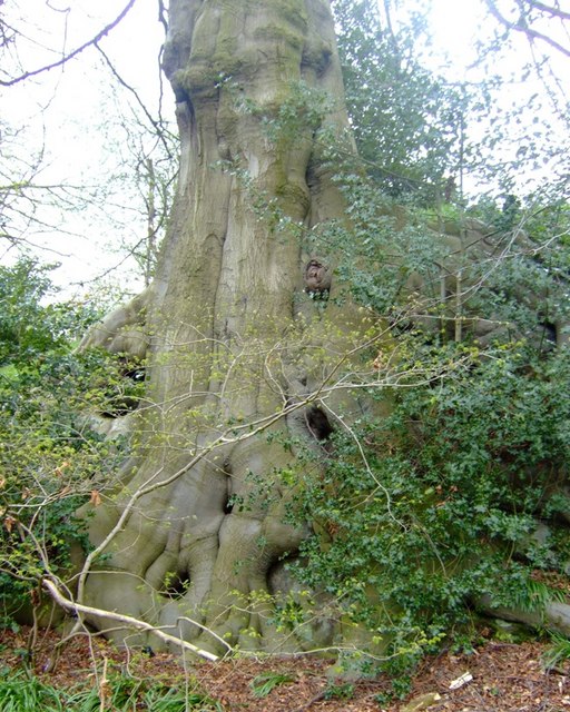
Image: © Simon Huguet Taken: 18 Apr 2008
The footpath from Maer winds up a sunken lane out of the village. The path is overshadowed by some huge trees, many of which, like this beech tree, have massive roots twining down over the steep sides and exposed rocks. The sides of the path are covered with bluebells [hyacynthoides non-scripta] and ramsons [allium ursinum].
Images are licensed for reuse under creativecommons.org/licenses/by-sa/2.0
Image Location
Latitude
52.93961
Longitude
-2.313026