River Kennet flooding, Newbury
Introduction
The photograph on this page of River Kennet flooding, Newbury by Oscar Taylor as part of the Geograph project.
The Geograph project started in 2005 with the aim of publishing, organising and preserving representative images for every square kilometre of Great Britain, Ireland and the Isle of Man.

There are currently over 7.5m images from over 14,400 individuals and you can help contribute to the project by visiting https://www.geograph.org.uk
River Kennet flooding, Newbury
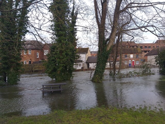
Image: © Oscar Taylor Taken: 7 Jan 2024
The River Kennet has reached a record high today of 1.59 metres. This has meant lots of the areas surrounding the river and canal have flooded. The water is very fast flowing through the town. The building in the background is Sally Ann's Charity Shop.
Images are licensed for reuse under creativecommons.org/licenses/by-sa/2.0
Image Location
Latitude
51.401801
Longitude
-1.325891