Looking east from Lady Hill
Introduction
The photograph on this page of Looking east from Lady Hill by Richard Sutcliffe as part of the Geograph project.
The Geograph project started in 2005 with the aim of publishing, organising and preserving representative images for every square kilometre of Great Britain, Ireland and the Isle of Man.

There are currently over 7.5m images from over 14,400 individuals and you can help contribute to the project by visiting https://www.geograph.org.uk
Looking east from Lady Hill
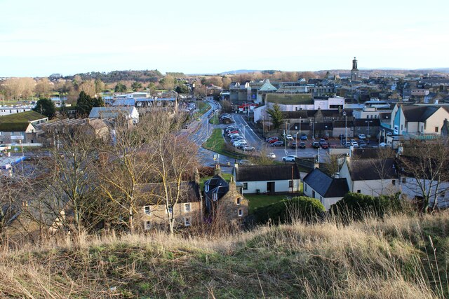
Image: © Richard Sutcliffe Taken: 6 Jan 2024
The A96 heads east towards Aberdeen. This is part of the Elgin Relief Road, which, when opened in 1981, resulted in the elimination of traffic from part of Elgin's High Street, where the tower of St Giles' Church can be seen in the distance
Images are licensed for reuse under creativecommons.org/licenses/by-sa/2.0
Image Location
Latitude
57.649129
Longitude
-3.318558