War Department boundary marker
Introduction
The photograph on this page of War Department boundary marker by Richard Law as part of the Geograph project.
The Geograph project started in 2005 with the aim of publishing, organising and preserving representative images for every square kilometre of Great Britain, Ireland and the Isle of Man.

There are currently over 7.5m images from over 14,400 individuals and you can help contribute to the project by visiting https://www.geograph.org.uk
War Department boundary marker
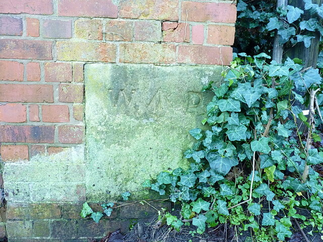
Image: © Richard Law Taken: 6 Jan 2024
Built into the northern boundary wall of what was once Copthorne Barracks (Sir John Moore Barracks), the headquarters of the King's Shropshire Light Infantry from the 1880s until its disbandment in the mid 1990s. This stone is quite weathered and hard to read, but at least some of the legend can be made out on close inspection as 'W D No ?? ?? N', and there is another similar stone at the base of a brick buttress a hundred yards or so further east Image A couple more have survived the demolition and redevelopment of much of the barracks, and remain in the southern perimeter wall Image & Image
Images are licensed for reuse under creativecommons.org/licenses/by-sa/2.0
Image Location
Latitude
52.712638
Longitude
-2.773398