
Kimmeridge Bay from Gaulter Gap
Introduction
The photograph on this page of Kimmeridge Bay from Gaulter Gap by Jim Champion as part of the Geograph project.
The Geograph project started in 2005 with the aim of publishing, organising and preserving representative images for every square kilometre of Great Britain, Ireland and the Isle of Man.

There are currently over 7.5m images from over 14,400 individuals and you can help contribute to the project by visiting https://www.geograph.org.uk
Kimmeridge Bay from Gaulter Gap
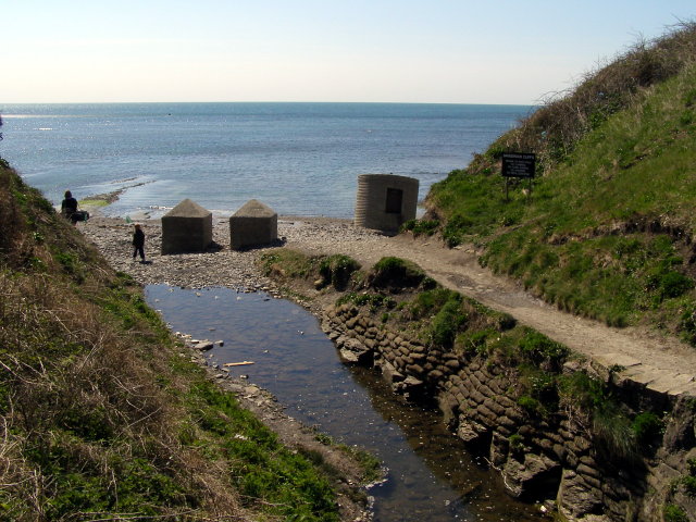
Image: © Jim Champion Taken: 16 Apr 2008
The stream in the foreground flows down from Kimmeridge village and out into the bay here through Gaulter Gap. The two concrete blocks on the left are relics from the Second World War, placed in the gap to impede the progress of any invasion from the sea. The concrete pillbox in the centre of the photo was once higher up on the cliff and is now fallen onto the pebbly beach.
Images are licensed for reuse under creativecommons.org/licenses/by-sa/2.0
Image Location

Latitude
50.611629
Longitude
-2.131385