Old Swan
Introduction
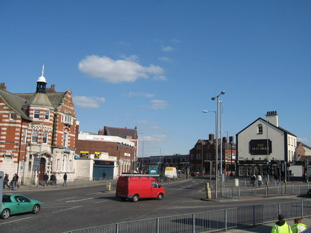
The photograph on this page of Old Swan by Sue Adair as part of the Geograph project.
The Geograph project started in 2005 with the aim of publishing, organising and preserving representative images for every square kilometre of Great Britain, Ireland and the Isle of Man.
There are currently over 7.5m images from over 14,400 individuals and you can help contribute to the project by visiting https://www.geograph.org.uk

Image: © Sue Adair Taken: 17 Apr 2008
Junction of Prescot Road and St Oswald Street, Old Swan. Old Swan takes its name from the original straw thatched coaching inn built in the early 17th century. Situated on a sandstone outcrop in heathland with views over the city it was a popular picnic spot. The inn, on the Prescot turnpike, had a cockpit at the rear and was situated at the corner of Broadgreen Road where the Red House is today (centre right). The later Old Swan pub (right of picture), built about 1775, is now probably the oldest building in the district.

