Modern Waymarker by UC road, 37 Brackenbed Lane
Introduction
The photograph on this page of Modern Waymarker by UC road, 37 Brackenbed Lane by Tony Wall as part of the Geograph project.
The Geograph project started in 2005 with the aim of publishing, organising and preserving representative images for every square kilometre of Great Britain, Ireland and the Isle of Man.

There are currently over 7.5m images from over 14,400 individuals and you can help contribute to the project by visiting https://www.geograph.org.uk
Modern Waymarker by UC road, 37 Brackenbed Lane
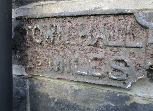
Image: © Tony Wall Taken: 26 Sep 2023
The Metal plaque is located in the wall on the side of the road. Parish of Halifax (Calderdale District). Metal plaque, erected in the 19th Century. Inscription reads:- TOWN HALL / 1½ MILES Milestone Society National ID: YW_XHAL
Images are licensed for reuse under creativecommons.org/licenses/by-sa/2.0
Image Location


Leaflet Map data © OpenStreetMap
Latitude
53.729445
Longitude
-1.8878