Charmouth from Stonebarrow Hill
Introduction
The photograph on this page of Charmouth from Stonebarrow Hill by David Purchase as part of the Geograph project.
The Geograph project started in 2005 with the aim of publishing, organising and preserving representative images for every square kilometre of Great Britain, Ireland and the Isle of Man.

There are currently over 7.5m images from over 14,400 individuals and you can help contribute to the project by visiting https://www.geograph.org.uk
Charmouth from Stonebarrow Hill
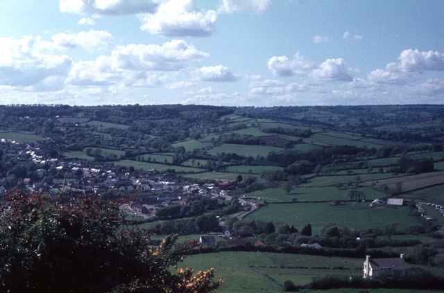
Image: © David Purchase Taken: 18 May 1966
At the time this was taken in 1966, the main A35 went through the village along the line running diagonally down from left to right. The bypass, not opened until 1990, runs about 300 metres (two field widths) further inland.
Images are licensed for reuse under creativecommons.org/licenses/by-sa/2.0
Image Location
Latitude
50.739358
Longitude
-2.898004