The Miley Dundee
Introduction
The photograph on this page of The Miley Dundee by stephen samson as part of the Geograph project.
The Geograph project started in 2005 with the aim of publishing, organising and preserving representative images for every square kilometre of Great Britain, Ireland and the Isle of Man.

There are currently over 7.5m images from over 14,400 individuals and you can help contribute to the project by visiting https://www.geograph.org.uk
The Miley Dundee
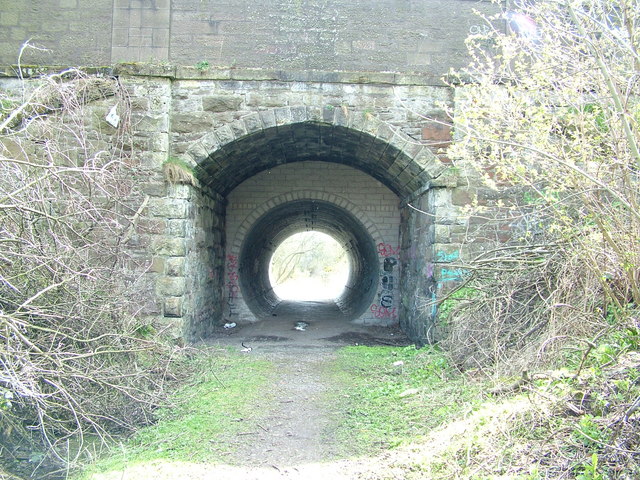
Image: © stephen samson Taken: 15 Apr 2008
The Miley is part of the disused Newtyle to Dundee railway. Used until 1967, the line was opened in 1859 and was used by both passenger and freight trains going to Newtyle. The Bridge in the photo has been strengthened to carry the weight of the road above.
Images are licensed for reuse under creativecommons.org/licenses/by-sa/2.0
Image Location


Leaflet Map data © OpenStreetMap
Latitude
56.474106
Longitude
-3.000258